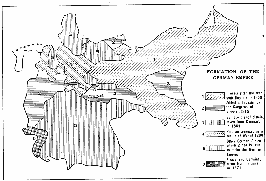
Description: A map showing the formation of the German Empire between 1806 and 1871. This map shows the territory of Prussia after the war with Napoleon in 1806, the territory added to Prussia by the Congress of Vienna in 1815, Schleswig and Holstein taken from Denmark in 1864, Hanover annexed after the War of 1866, the German states which joined Prussia to make the German Empire, and Alsace and Lorraine territories taken from France in 1871.
Place Names: Germany, Prussia, �Schleswig, �Holstein, �Hanover, �Alsace, �Lorrain
ISO Topic Categories: boundaries
Keywords: Formation of the German Empire, physical, �political, �historical, physical features, country borders,
major political subdivisions, boundaries, Unknown, 1806–1871
Source: L. P. Benezet, The Story of the Map of Europe (Chicago, Illinois: Scott, Foresman and Company, 1916) 158
Map Credit: Courtesy the private collection of Roy Winkelman |
|