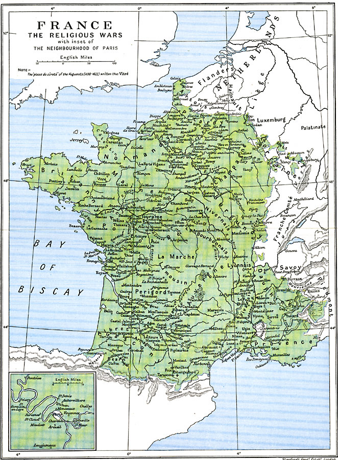
Description: A map of France during the Wars of Religion (1562–1598) up to the Treaty of Montpellier (1622). The French Wars of Religion dealt with reformation between the Catholics and Protestants (Huguenots), however, the eight civil wars were also a struggle between the House of Guise (Catholic) and the House of Bourbon (Protestant) for the French throne. The Treaty of Montpellier, between King Louis XIII and Duke Henry II, allowed the Huguenots to keep their forts and garrisons, which are noted on this map as "places du sûreté," and are shown in bold rather than italic type. There is an inset mat detailing the environs of Paris, showing important cities at the time of the wars.
Place Names: France, Bordeaux, �Dunkerque, �Grenoble, �Lyon, �Nancy, �Nice, �Orleans, �Paris, �Starsbourg, �Tour
ISO Topic Categories: oceans,
location,
inlandWaters,
boundaries
Keywords: France - The Religious Wars, political, �religious, �statistical, country borders,
major political subdivisions,
local jurisdictions, oceans,
location,
inlandWaters,
boundaries, Unknown, 1598–1622
Source: Ward, Prothero, and Leathes, The Cambridge Modern History Atlas (New York, NY: The Macmillan Company, 1912)
Map Credit: Courtesy the private collection of Roy Winkelman |
|