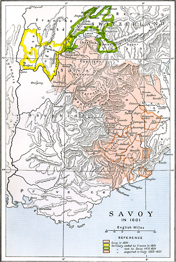
Description: A map of Savoy (Duchy of Savoy) in 1601 at the time of the Treaty of Lyon. This map is color–coded to show areas ceded to France (Bresse and Burgundy), territories lost to Switzerland (1475–1601), and the territories acquired from Italy between 1503 and 1601. This map shows the Savoy provinces of Chablais, Faucigny, Genevois, Tarantaise, Maurienne, Saluzzo, Nice, and Piedmont, major cities, rivers, and mountain systems of the region.
Place Names: Western Europe, France, �Germany, �Italy, �Switzerlan
ISO Topic Categories: oceans,
location,
inlandWaters,
boundaries
Keywords: Savoy, political, local jurisdictions,
country borders,
major political subdivisions, oceans,
location,
inlandWaters,
boundaries, Unknown, 1601
Source: Ward, Prothero, and Leathes, The Cambridge Modern History Atlas (New York, NY: The Macmillan Company, 1912)
Map Credit: Courtesy the private collection of Roy Winkelman |
|