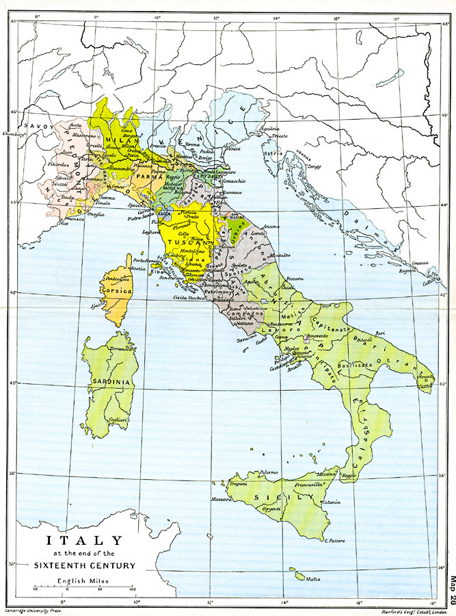
Description: Map of Italy at the end of the 16th Century showing the territorial boundaries and claims on the peninsula, islands, and northern regions, important cities of the time, rivers, and coastal features. This map is color–coded to show the different territories, including Piedmont, Genoa, Montferrat, Milan, Parma, Venice, Mantua, Modena, Ferrara, Lucca, Tuscany, Urbino, San Marino, Benevento, Stato degli Presidi, Corsica, and Sardinia. The Papal States of Bologna, Romagna, Perugia, Ancona, Spoleto, Patrimony, and Campagna are shown, as well as the Naples territories of Abruzzi, Capitanata, Molise, Lavoro, Principato, Basilicata, Bari, Otranto, Calabria, and the islands of Sicily and Malta.
Place Names: Italy, Calabria, �Corsica, �Ferrara, �Italy, �Milan, �Naples, �Parma, �Sardinia, �Tuscan
ISO Topic Categories: oceans,
location,
inlandWaters,
boundaries
Keywords: Italy, political, local jurisdictions,
country borders,
major political subdivisions, oceans,
location,
inlandWaters,
boundaries, Unknown, 1600
Source: Ward, Prothero, and Leathes, The Cambridge Modern History Atlas (New York, NY: The Macmillan Company, 1912)
Map Credit: Courtesy the private collection of Roy Winkelman |
|