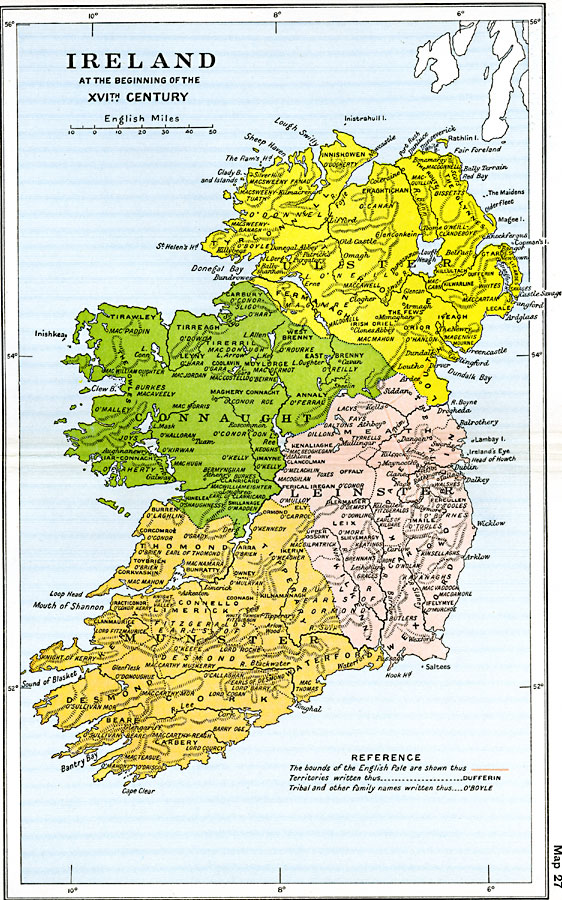
Description: A map of Ireland at the beginning of the 1500s and prior to the ascension of Queen Elizabeth (1558). This map is color–coded to show the boundaries of the four provinces of Ireland (Ulster, Connaught, Leinster, and Munster), and the boundary of the English Pale from Dundalk Bay southwest to Kells, then south to Kilcullen and Dalkey around the area of Dublin. Territories are labeled in bold caps, tribal and other family names are labeled in italicized caps.
Place Names: Ireland, Connaught, �Cork, �Dublin, �Galway, �Leinstar, �Munster, �Ulste
ISO Topic Categories: oceans,
location,
inlandWaters,
boundaries
Keywords: Ireland, political, local jurisdictions,
country borders,
major political subdivisions, oceans,
location,
inlandWaters,
boundaries, Unknown, Early 1500's
Source: Ward, Prothero, and Leathes, The Cambridge Modern History Atlas (New York, NY: The Macmillan Company, 1912)
Map Credit: Courtesy the private collection of Roy Winkelman |
|