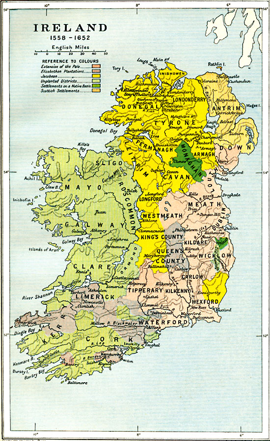
Description: A map of Ireland from the ascension of Queen Elizabeth (1558) to the end of the Cromwellian conquest and the Act for the Settlement of Ireland (1652). This map is color–coded to show the territories of the expanded English Pale, the Elizabethan Plantations, the Jacobean territories (under King James I), unplanted districts, settlements on a Native basis, and Scottish settlements.The map also shows the locations of several battle sites, including Rathmines, Scariffholis, Benburb, Sligo, Curlew Pass, Clones, Dangan Hill, Kilrush, Affane, and Kinsale.
Place Names: Ireland, Ireland, �Cork, �Dublin, �Foynes, �Galway, �Killarney, �Limerick, �Londonderry, �Monaghan, �New Ross, �Shannon, �Sligo, �Tipperar
ISO Topic Categories: oceans,
location,
inlandWaters,
boundaries
Keywords: Ireland, political, �historical, �statistical, local jurisdictions,
country borders,
major political subdivisions, agriculture, other military, oceans,
location,
inlandWaters,
boundaries, Unknown, 1558–1652
Source: Ward, Prothero, and Leathes, The Cambridge Modern History Atlas (New York, NY: The Macmillan Company, 1912)
Map Credit: Courtesy the private collection of Roy Winkelman |
|