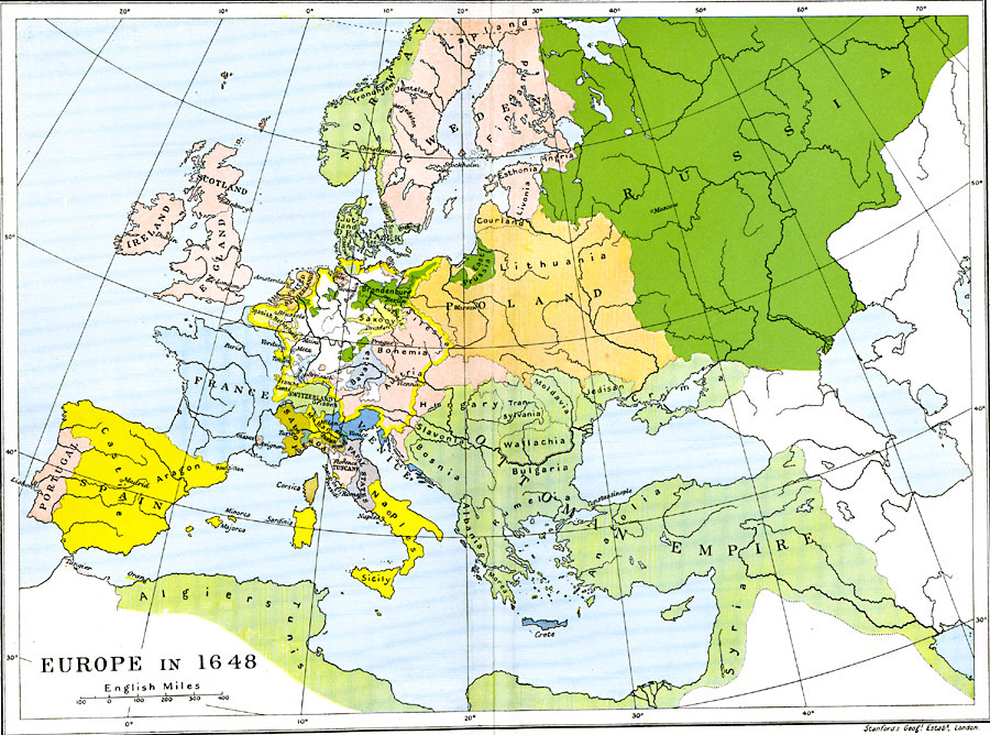
Description: A Map of Europe in 1648. Map is color–coded to differentiate between the various countries and includes capital cities and major rivers.
Place Names: A Complete Map of Europe, Austria, �Bavaria, �Bohemia, �Denmark, �England, �France, �Ireland, �Lithuania, �Ottoman Empire, �Poland, �Portugal, �Russia, �Sicily, �Spain, �Sweden, �Switzerlan
ISO Topic Categories: oceans,
location,
inlandWaters,
boundaries
Keywords: Europe, political, local jurisdictions,
country borders,
major political subdivisions, oceans,
location,
inlandWaters,
boundaries, Unknown, 1648
Source: Ward, Prothero, and Leathes, The Cambridge Modern History Atlas (New York, NY: The Macmillan Company, 1912)
Map Credit: Courtesy the private collection of Roy Winkelman |
|