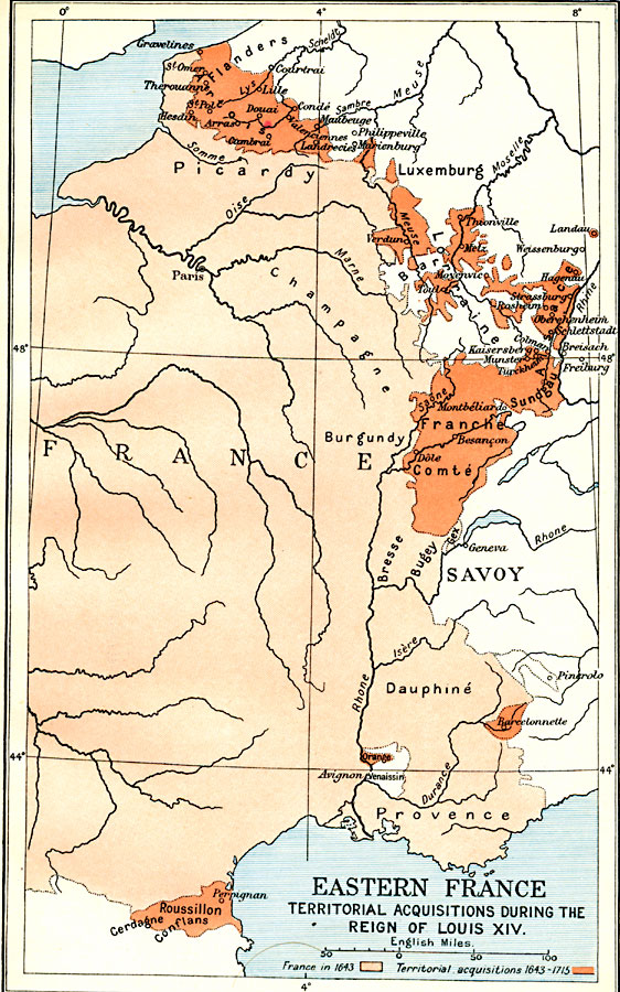
Description: A map of Eastern France, subtitled "Territorial Acquisitions during the Reign of Louis XIV." This map is color–coded to show the territory of eastern France in 1643, and France's territorial acquisitions under Louis XIV during 1643–1715, including Artois and the western portion of Flanders, Verdun, Metz, Strassburg (Strasbourg), Sundgau, Franche Comté, Barcelonnette, Orange near Avignon, and Roussillon on the border with Spain.
Place Names: France, Burgundy, �Champagne, �Dauphine, �Flanders, �Luxemburg, �Picardy, �Provence, �Roussillon, �Verdu
ISO Topic Categories: oceans,
location,
inlandWaters,
boundaries
Keywords: Eastern France, political, �historical, local jurisdictions,
country borders,
major political subdivisions, historical event, oceans,
location,
inlandWaters,
boundaries, Unknown, 1643–1715
Source: Ward, Prothero, and Leathes, The Cambridge Modern History Atlas (New York, NY: The Macmillan Company, 1912)
Map Credit: Courtesy the private collection of Roy Winkelman |
|