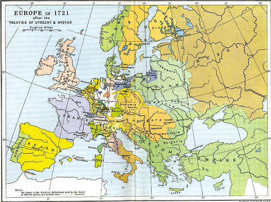
Description: A map of Europe in 1721 after the Treaty of Utrecht ending the War of the Spanish Succession, and the Treaty of Nystad ending the Great Northern War between Sweden and the Russians and Danes. The map shows the northern territories of Denmark–Norway, Sweden–Finland, Poland, and portions of Russia including Esthonia, Ingria, and Livonia. The map also shows the territories of the Confederation of the Rhine, the political divisions of the Italian peninsula, and the extent of the Turkish Ottoman Empire at the time.
Place Names: A Complete Map of Europe, Austria, �Bavaria, �Bohemia, �Denmark, �England, �France, �Holland, �Hungary, �Ireland, �Italy, �Netherlands, �Norway, �Poland, �Portugal, �Prussia, �Russia, �Sicily, �Spain, �Sweden, �United Kingdo
ISO Topic Categories: oceans,
location,
inlandWaters,
boundaries
Keywords: Europe after the Treaties of Utrecht and Nystad, political, �historical, local jurisdictions,
country borders,
major political subdivisions, historical event, oceans,
location,
inlandWaters,
boundaries, Unknown, 1721
Source: Ward, Prothero, and Leathes, The Cambridge Modern History Atlas (New York, NY: The Macmillan Company, 1912)
Map Credit: Courtesy the private collection of Roy Winkelman |
|