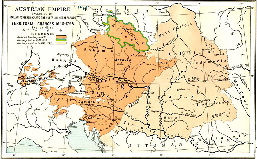
Description: A map of the Austrian Empire, exclusive of the Italian Possessions and the Austrian Netherlands, subtitled, "Territorial Changes 1648–1795." The map is color–coded to show territories acquired and lost during this period.
Place Names: Western and Central Europe, Bohemia, �Croatia, �Galicia, �Hungary, �Silesia, �Slavonia, �Transylvania, �Tyro
ISO Topic Categories: oceans,
location,
inlandWaters,
boundaries
Keywords: Austrian Empire, political, �historical, local jurisdictions,
country borders, historical event,
other military, oceans,
location,
inlandWaters,
boundaries, Unknown, 1648–1795
Source: Ward, Prothero, and Leathes, The Cambridge Modern History Atlas (New York, NY: The Macmillan Company, 1912)
Map Credit: Courtesy the private collection of Roy Winkelman |
|