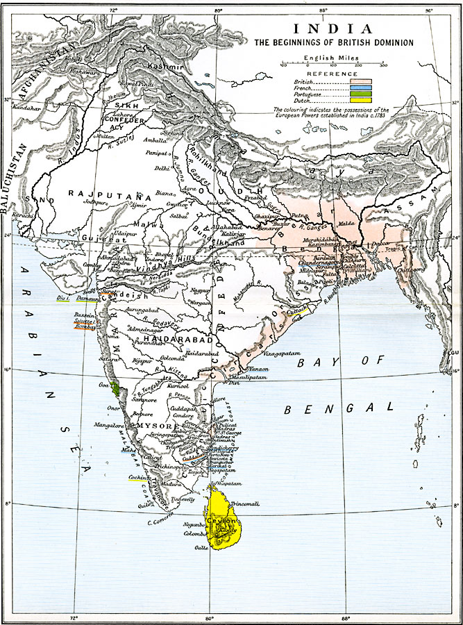
Description: A map of India, subtitled "The Beginnings of British Dominion." This map is color–coded to show the possessions of Britain, France, Portugal, and the Netherlands established in India, circa 1783, at the time of the aborted India Bill (1783), by which British Parliament attempted to reform the East India Company. The map shows the non–European territories, including Assam, Oudh (Awadh), Rajputana, the Sikh Confederacy, Afghanistan, Kashmir, Baluchistan, Sind, Rohilkhand, Hyderabad, Mysore, and others. The map shows mountain systems and terrain, rivers, and coastal features.
Place Names: India , Assam, �Bundelkand, �Gujerat, �Haidarabad, �Malwa, �Oudh, �Rajputan
ISO Topic Categories: oceans,
location,
inlandWaters,
boundaries
Keywords: India, political, local jurisdictions,
country borders,
major political subdivisions, oceans,
location,
inlandWaters,
boundaries, Unknown, 1783
Source: Ward, Prothero, and Leathes, The Cambridge Modern History Atlas (New York, NY: The Macmillan Company, 1912)
Map Credit: Courtesy the private collection of Roy Winkelman |
|