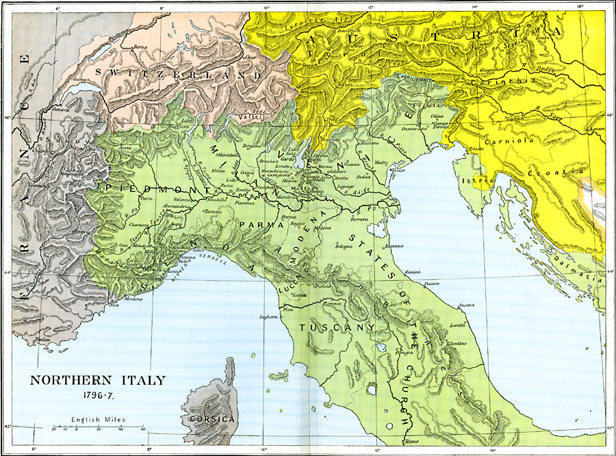
Description: A map of Northern Italy in 1796–1797 during the French Revolutionary Wars, subtitled "Bonaparte's Campaign." This map shows the Piedmont locations of Montenotte (1796) northeast of Nice, Dego, and Mondovi near Turin, the Po River crossing at Piacenza and nearby Lodi, the siege of Mantua, battle sites of Castiglione, Lonato, Roveredo, Bassano, and Caldiero, Arcole, and Rivoli (1797) along the River Adige. The map is color–coded to show the boundaries of Italy, France, Switzerland, and Austria at the time.
Place Names: Italy, Genoa, �Milan, �Parma, �Piedmont, �Tuscany, �Venic
ISO Topic Categories: oceans,
location,
inlandWaters
Keywords: Northern Italy, political, kNapoleonicWars, country borders,
major political subdivisions,
local jurisdictions, oceans,
location,
inlandWaters, Unknown, 1796–1797
Source: Ward, Prothero, and Leathes, The Cambridge Modern History Atlas (New York, NY: The Macmillan Company, 1912)
Map Credit: Courtesy the private collection of Roy Winkelman |
|