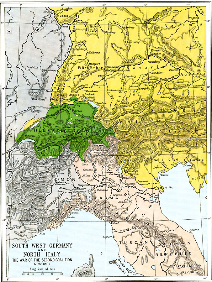
Description: A map of southwest Germany, Switzerland, and northern Italy during the French Revolutionary Wars, subtitled "The War of the Second Coalition 1798–1801." The map is color–coded to show the territories of the Holy Roman Empire under the Habsburgs in southern Germany and Austria, the Helvetic Republic established by the French, and the areas in northern Italy not under French control. The map shows important cities of the time, including Marengo in the Piedmont and Hohenlinden in Bavaria, where the French Army won decisive battles against the Coalition forces.
Place Names: Western and Central Europe, Austria, �Bavaria, �Bohemia, �Germany, �Helvetic Republic, �Italy, �Parma, �Salzburg, �Tuscany, �Tyrol, �Venice, �Wurtembur
ISO Topic Categories: oceans,
location,
inlandWaters,
boundaries
Keywords: Southwest Germany and North Italy, political, �historical, kNapoleonBonaparte, country borders,
major political subdivisions,
local jurisdictions, other military, oceans,
location,
inlandWaters,
boundaries, Unknown, 1798–1801
Source: Ward, Prothero, and Leathes, The Cambridge Modern History Atlas (New York, NY: The Macmillan Company, 1912)
Map Credit: Courtesy the private collection of Roy Winkelman |
|