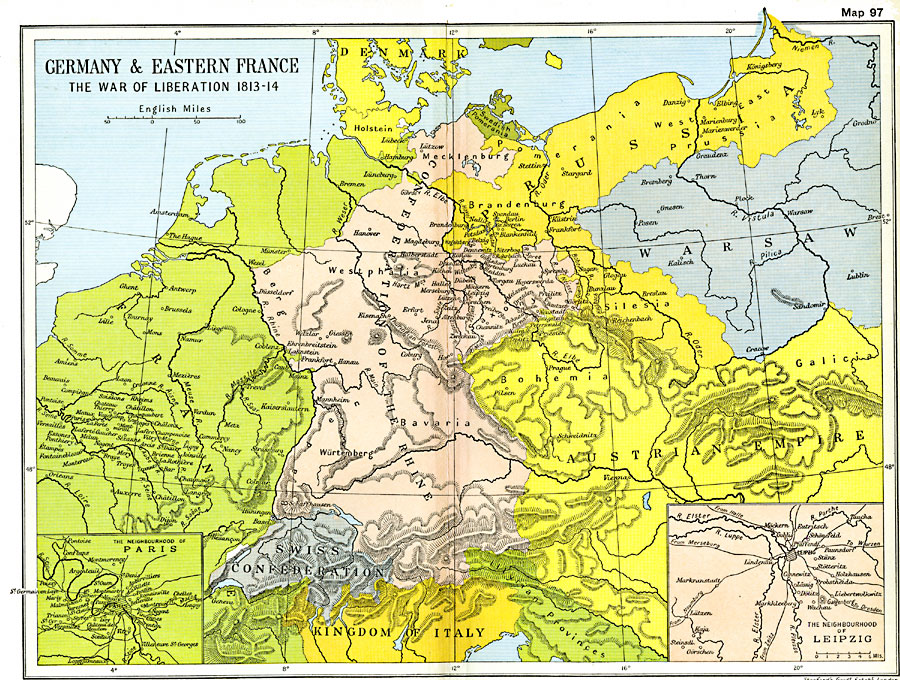
Description: A map of Germany and eastern France in 1813–14 during the War of the Sixth Coalition of the Napoleonic Wars. This map shows the territories of Denmark, Swedish Pomerania, Prussia, Confederation of the Rhine, and the Swiss Confederation, as well as portions of Napoleon's France, Warsaw, and the Austrian Empire. The map shows important cities of the conflict, including two inset maps detailing the environs of Paris, and of Leipzig, site of Napoleon's defeat at the Battle of Leipzig or Battle of Nations.
Place Names: Western and Central Europe, Bavaria, �Brandenburg, �Geneva, �Mecklenburg, �Paris, �Westphalia, �Wurtemburg, Leipzig
ISO Topic Categories: oceans,
location,
inlandWaters,
boundaries
Keywords: Germany and Eastern France, political, �historical, kNapoleonBonaparte, kNapoleonicWars, country borders,
major political subdivisions,
local jurisdictions, historical event,
other military, oceans,
location,
inlandWaters,
boundaries, Unknown, 1813–1814
Source: Ward, Prothero, and Leathes, The Cambridge Modern History Atlas (New York, NY: The Macmillan Company, 1912)
Map Credit: Courtesy the private collection of Roy Winkelman |
|