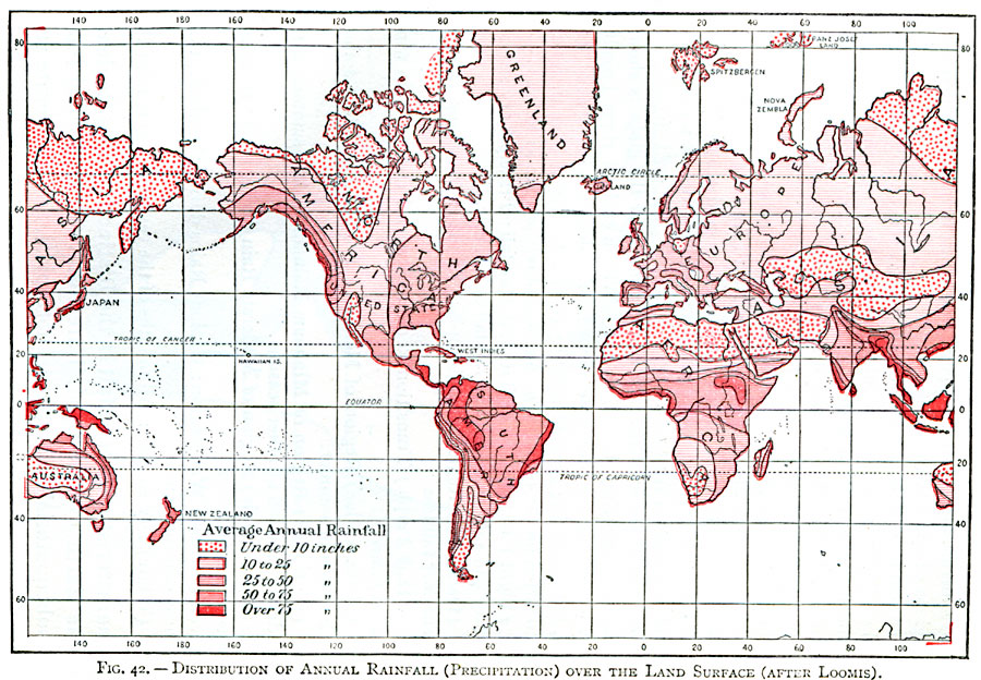
Description: A map of the Earth from 1896, showing the average distribution of annual rainfall (precipitation) over the land surface, from areas where less than 10 inches fall annually to areas where an excess of 75 inches fall.
Place Names: A Complete Map of Globes and Multi-continent, Africa, �Antarctica, �Asia, �Australia, �Europe, �North America, �South Americ
ISO Topic Categories: climatologyMeteorologyAtmosphere,
inlandWaters,
location,
oceans
Keywords: Mean Global Annual Rainfall, physical, �meteorological, kClimate, physical features, rainfall, climatologyMeteorologyAtmosphere,
inlandWaters,
location,
oceans, Unknown, 1896
Source: Frank Waldo, Elementary Meteorology (New York, New York: American Book Company, 1896) 149
Map Credit: Courtesy the private collection of Roy Winkelman |
|