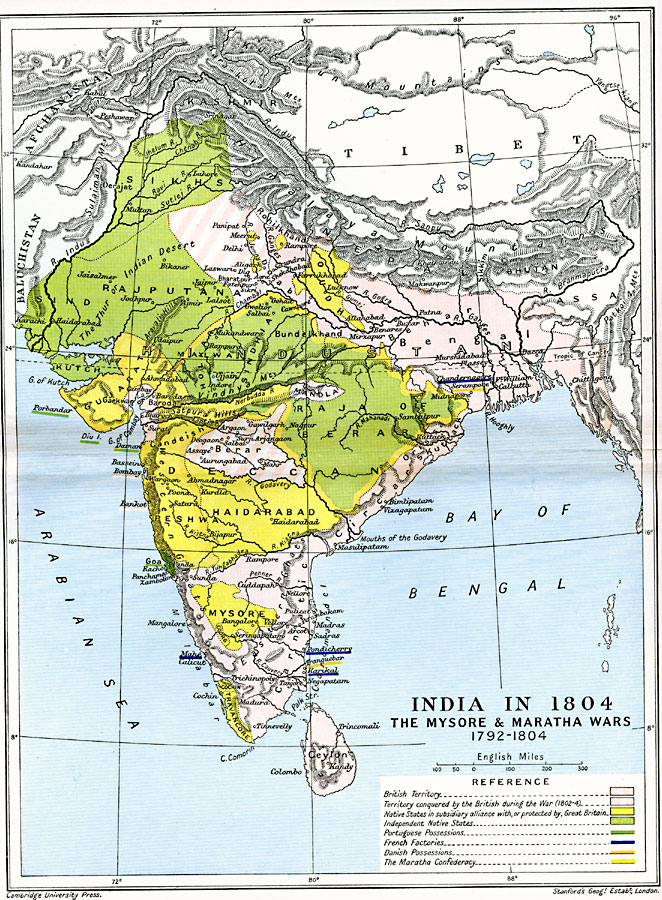
Description: A map of Hindustan (India) from the end of the Third Anglo–Mysore War (1789–1792) to the Second Maratha War (1803–1804). This map is color–coded to show the British possessions at the time, the territories conquered by the British during the Second Maratha War, the Native States in subsidiary alliance with, or protected by, Great Britain, the Independent Native States, Portuguese possessions, French Factories, Danish possessions, and the boundaries of the Maratha Confederacy. Major cities, rivers, terrain and coastal features are shown.
Place Names: India , Bengal, �Gujarat, �Haidarabad, �Mysore, �Oudh, �Peshwa, �Rajputana, �Sikhs, �Travancore,
ISO Topic Categories: oceans,
location,
inlandWaters,
boundaries
Keywords: India, political, �historical, country borders,
major political subdivisions,
local jurisdictions, historical event,
other military, oceans,
location,
inlandWaters,
boundaries, Unknown, 1792–1804
Source: Ward, Prothero, and Leathes, The Cambridge Modern History Atlas (New York, NY: The Macmillan Company, 1912)
Map Credit: Courtesy the private collection of Roy Winkelman |
|