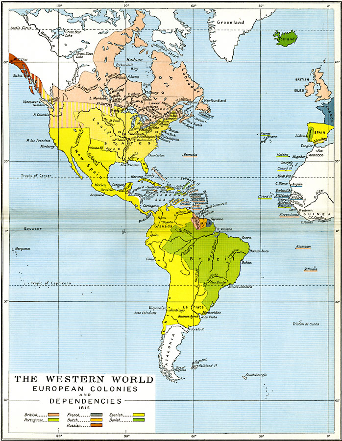
Description: A map of the Western World, subtitled "European Colonies and Dependencies in 1815." This map is color–coded to show lands controlled by Britain, France, Spain, Portugal, Netherlands, Denmark, and Russia in North and South America at the time, and includes settlements on the west coast of Africa and Iceland. The map shows with barred colors the disputed territories in the Pacific Northwest west to the Mississippi between Britain and Spain, and along the Canadian Pacific coast between Britain and Russia.
Place Names: Regional Americas, Bahamas, �Belize, �Brazil, �Chile, �Cuba, �France, �Great Britain, �Guiana, �Iceland, �Jamaica, �North America, �Peru, �Portugal, �South America, �Spai
ISO Topic Categories: political, kWorldAmericas, kWorldEuroAfrica, kWorldAtlantic
Keywords: European Colonies and Dependencies of the Western World, political, country borders,
local jurisdictions,
major political subdivisions, political, kWorldAmericas, kWorldEuroAfrica, kWorldAtlantic, Unknown, 1815
Source: Ward, Prothero, and Leathes, The Cambridge Modern History Atlas (New York, NY: The Macmillan Company, 1912)
Map Credit: Courtesy the private collection of Roy Winkelman |
|