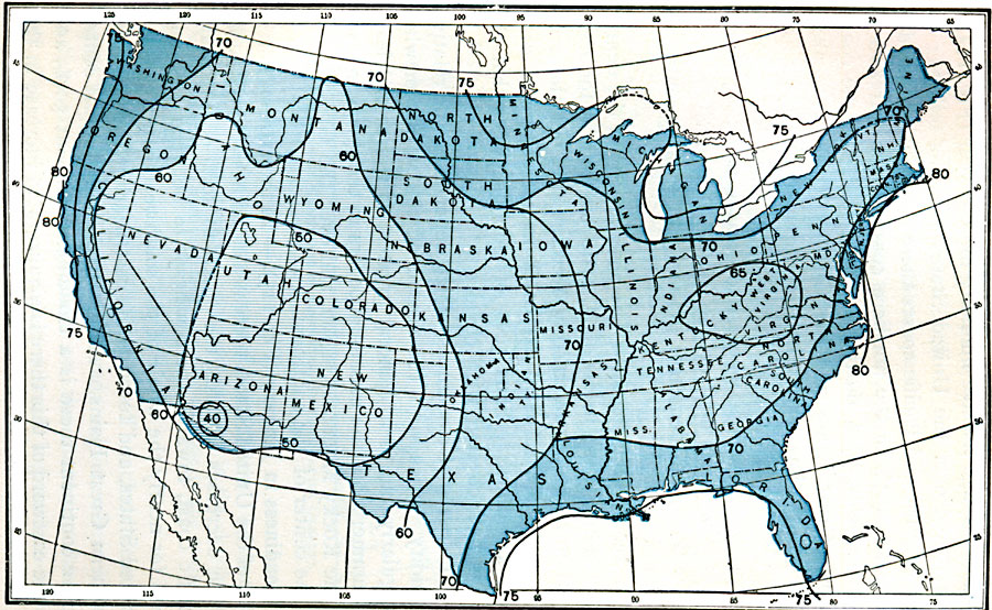
Description: A map from 1896 of the United States showing the average relative humidity for the region, given in the percentage of water per cubic foot of surface air relative to air temperature.
Place Names: Meteorology, humidit
ISO Topic Categories: boundaries,
inlandWaters,
location,
oceans,
climatologyMeteorologyAtmosphere
Keywords: Relative Humidity, physical, �political, �meteorological, kClimate, physical features, major political subdivisions,
country borders, climate, boundaries,
inlandWaters,
location,
oceans,
climatologyMeteorologyAtmosphere, Unknown, 1896
Source: Frank Waldo, Elementary Meteorology (New York, NY: American Book Company, 1896) 351
Map Credit: Courtesy the private collection of Roy Winkelman |
|