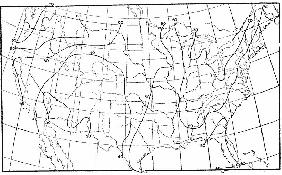
Description: A map from 1896 of the United States showing the percentage of cloudiness in the region for the month of January (midwinter), where 0% is clear and 100% is completely cloudy. "In the extreme northwest of the United States there is a cloudiness of over 70%, which decreases toward the south to 40% on the south Pacific coast, towards the southeast to between 30% and 40% for nearly the whole of the southwestern United States, and towards the east nearly to 40% on the northern Great Plains." Waldo, 1896, pp. 353–354.
Place Names: Meteorology, cloud coverage, �cloudines
ISO Topic Categories: climatologyMeteorologyAtmosphere,
inlandWaters,
oceans
Keywords: Midwinter Cloudiness, physical, �meteorological, kClimate, physical features, climate, climatologyMeteorologyAtmosphere,
inlandWaters,
oceans, Unknown, 1896
Source: Frank Waldo, Elementary Meteorology (New York, NY: American Book Company, 1896) 353
Map Credit: Courtesy the private collection of Roy Winkelman |
|