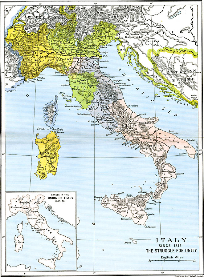
Description: A map of Italy between 1815 and 1870 subtitled "The Struggle for Unity." The map is color–coded to show lands acquired & ceded during this period, with an inset map showing dates of annexation to the Kingdom of Sardinia (Kingdom of Italy, 1861) for Lombardy (1859), Parma, Modena, Romagna, Tuscany, Marches, and Umbria (1860), The Two Sicilies (1861), Venetia (1866), and the Patrimony of St. Peter (1870).
Place Names: Italy, Bologna, �Florence, �Genoa, �Messina, �Milan, �Naples, �Pisa, �Rome, �Sicily, �Tuscany, �Venice, �Veron
ISO Topic Categories: oceans,
location,
inlandWaters,
boundaries
Keywords: Italy, political, �historical, country borders,
local jurisdictions,
major political subdivisions, historical event, oceans,
location,
inlandWaters,
boundaries, Unknown, 1815–1871
Source: Ward, Prothero, and Leathes, The Cambridge Modern History Atlas (New York, NY: The Macmillan Company, 1912)
Map Credit: Courtesy the private collection of Roy Winkelman |
|