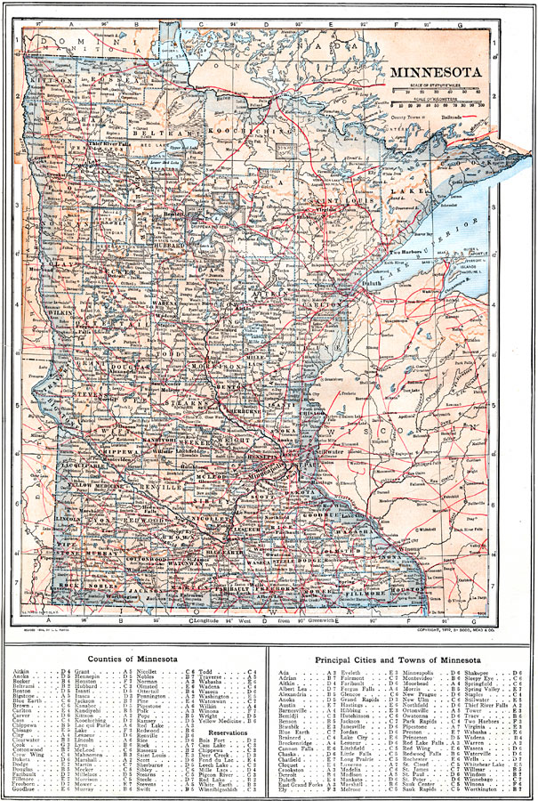
Description: A map from 1914 of Minnesota showing the capital of St. Paul, counties and county seats, major cities and towns, Indian reservations, railroads, lakes, and rivers, including the headwaters of the Mississippi River. A grid reference at the bottom of the map lists counties, principal cities, and towns of Minnesota.
Place Names: Minnesota, Mankato, �St. Paul, �Minneapolis, �St. Cloud, �Faribault, �Anoka, �Red Wing, �Rochester, �Winona, �Worthingto
ISO Topic Categories: boundaries,
inlandWaters,
location,
transportation
Keywords: Minnesota, physical, �political, �transportation, kNativeAmerican, physical features, country borders, railroads, boundaries,
inlandWaters,
location,
transportation, Unknown, 1914
Source: , The New Encyclopedic Atlas and Gazetteer of the World (New York, NY: P. F. Collier and Son, 1914) 30
Map Credit: Courtesy the private collection of Roy Winkelman |
|