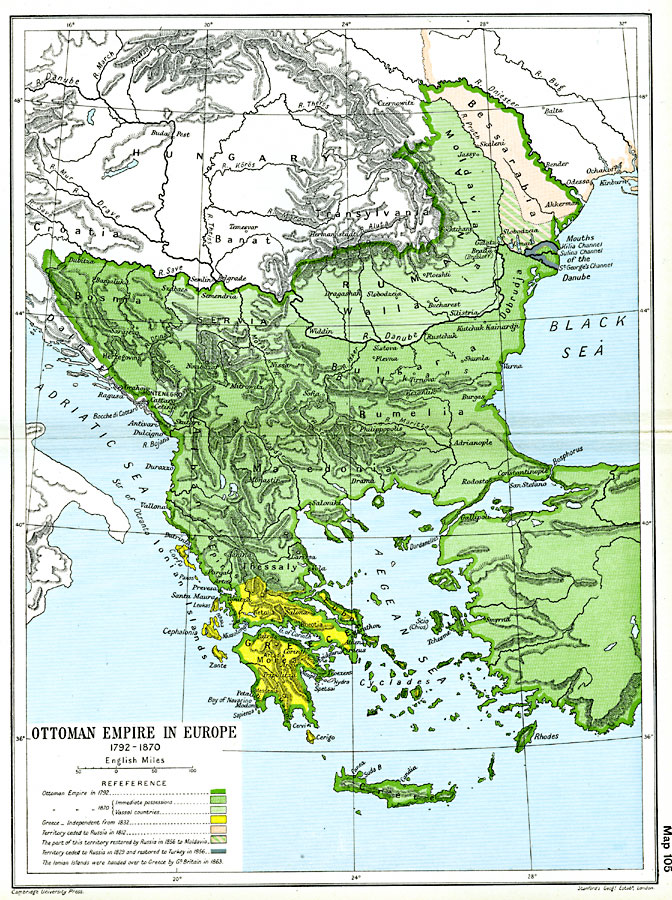
Description: A map of the Ottoman Empire in Europe between 1792 and 1870. The map is color–coded to show the boundaries of the Empire in 1792 at the end of the Russo–Turkish War (1787–1792), the territory ceded to Russia in 1812, the territory ceded to Russia in 1829 and restored to Turkey in 1856, the Greek territory as independent from the Ottoman Empire since 1832, the territory restored by Russia in 1856 to Moldavia, and the immediate and vassal countries of the Ottoman Empire in 1870. This map shows important cities of the time, major rivers and mountain systems, the Danube River delta, and a notation of the Ionian Islands being turned over to Greece by Great Britain in 1863.
Place Names: Southeastern Europe, Bessarabia, �Bosnia, �Bulgaria, �Greece, �Macedonia, �Romania, �Rumania, �Serbi
ISO Topic Categories: oceans,
location,
inlandWaters,
boundaries
Keywords: Ottoman Empire in Europe, political, �historical, kEuropeanOttomanEmpire, country borders,
local jurisdictions,
major political subdivisions, historical event, oceans,
location,
inlandWaters,
boundaries, Unknown, 1792–1870
Source: Ward, Prothero, and Leathes, The Cambridge Modern History Atlas (New York, NY: The Macmillan Company, 1912)
Map Credit: Courtesy the private collection of Roy Winkelman |
|