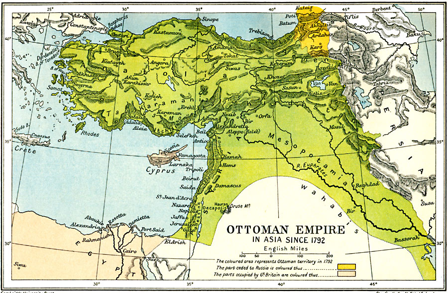
Description: A map from 1912 showing the Ottoman Empire in Asia since 1792. This map is color-coded to show the Ottoman territory in Asia Minor from the Black Sea through Mesopotamia to the Persian Gulf and along the Mediterranean to Egypt, the territories around Kars and Batum ceded to Russia at the end of the Crimean War (1856), and the territories of Cyprus and Egypt occupied by Great Britain. The map shows major cities, terrain, lakes, and rivers of the region.
Place Names: Southwest Asia, Anatolia, �Armenia, �Cyprus, �Egypt, �Kars, �Kurdistan, �Mesopotamia, �Syri
ISO Topic Categories: oceans,
location,
inlandWaters,
boundaries
Keywords: Ottoman Empire in Asia, political, kOttomanEmpire, country borders,
local jurisdictions,
major political subdivisions, oceans,
location,
inlandWaters,
boundaries, Unknown, 1800s
Source: Ward, Prothero, and Leathes, The Cambridge Modern History Atlas (New York, NY: The Macmillan Company, 1912)
Map Credit: Courtesy the private collection of Roy Winkelman |
|