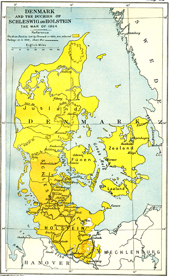
Description: A map of Denmark and the Duchies of Schleswig and Holstein in 1864, subtitled "The War of 1864." The map is color–coded to show the three duchies lost by Denmark to Germany in 1864, Schleswig, Holstein, and Lauenburg. The map shows important cities and railways of the time.
Place Names: Denmark, Abenra, �Alborg, �Copenhagen, �Esbjerg, �Funen, �Helsinger, �Holstein, �Kolding, �Laaland, �Langeland, �Randers, �Ronne, �Roskilde, �Schleswig, �Skagen, �Zealan
ISO Topic Categories: oceans,
location,
inlandWaters,
boundaries
Keywords: Denmark and the Duchies of Schleswig and Holstein, political, �historical, �transportation, country borders,
local jurisdictions,
major political subdivisions, railroads, other military, oceans,
location,
inlandWaters,
boundaries, Unknown, 1864
Source: Ward, Prothero, and Leathes, The Cambridge Modern History Atlas (New York, NY: The Macmillan Company, 1912)
Map Credit: Courtesy the private collection of Roy Winkelman |
|