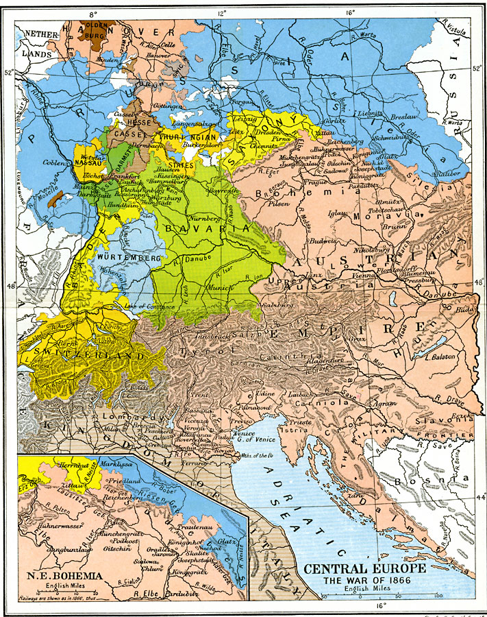
Description: A map of Central Europe during the War of 1866, also referred to as the Austro–Prussian War, the Seven Weeks War, or the German Civil War. The map is color–coded to distinguish between countries, and shows Austrian alliance countries and city states of Saxony, Bavaria, Baden, Württemberg, Hanover, Hesse, Hesse–Cassel, Thuringian States, Schaumburg, Frankfurt, and Nassau, and the Prussian alliance countries of the Kingdom of Italy, Oldenburg, and Brunswick. The inset map details northeast Bohemia, site of the Battle of Königgrätz, where the Prussian army under Moltke had a decisive victory over the Austrian army under Benedek, leading to the armistice being signed in Prague three weeks later.
Place Names: Western and Central Europe, Austria, �Baden, �Bavaria, �Bohemia, �Hanover, �Italy, �Prussia, �Saxony, �Switzerlan
ISO Topic Categories: oceans,
location,
inlandWaters,
boundaries
Keywords: Central Europe and the War of 1866, political, �historical, �transportation, country borders,
local jurisdictions,
major political subdivisions, railroads, other military, oceans,
location,
inlandWaters,
boundaries, Unknown, 1866
Source: Ward, Prothero, and Leathes, The Cambridge Modern History Atlas (New York, NY: The Macmillan Company, 1912)
Map Credit: Courtesy the private collection of Roy Winkelman |
|