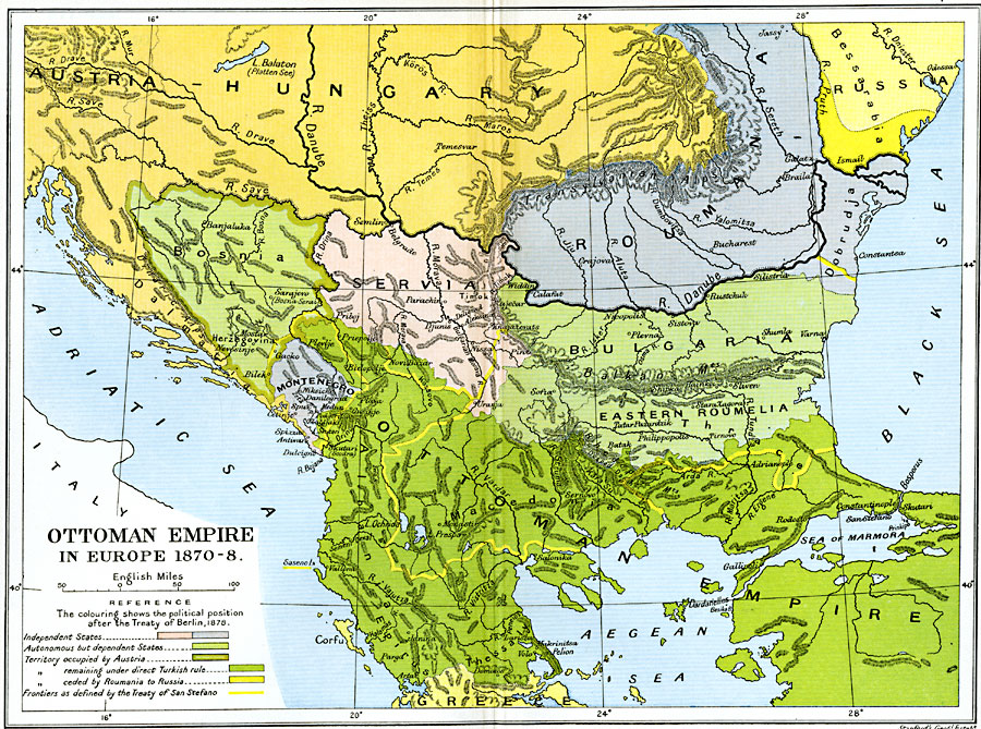
Description: A map of the Ottoman Empire in Europe from 1870–1878. Map is color–coded to show political boundaries after the Russo–Turkish War of 1877–1878 and the Treaty of Berlin in 1878. The map shows the independent states of Roumania (Romania), Serbia, and Montenegro, the autonomous but dependent states of Bulgaria, Eastern Roumelia, and Bosnia, and the Turkish frontier established by the Treaty of San Stefano (March 3, 1878). The map also shows Bosnia as occupied by the Austrians (Sarajevo and the Archduke Ferdinand of Austria), and the crescent of Roumanian territory north of the Danube Delta and east of the Pruth River being ceded by the Romanians to Russia.
Place Names: Southeastern Europe, Austria, �Bosnia, �Bulgaria, �Dalmatia, �Greece, �Hungary, �Macedonia, �Romania, �Roumania, �Servi
ISO Topic Categories: oceans,
location,
inlandWaters,
boundaries
Keywords: Ottoman Empire in Europe, political, �historical, kEuropeanOttomanEmpire, country borders,
local jurisdictions,
major political subdivisions, other military, oceans,
location,
inlandWaters,
boundaries, Unknown, 1870–1878
Source: Ward, Prothero, and Leathes, The Cambridge Modern History Atlas (New York, NY: The Macmillan Company, 1912)
Map Credit: Courtesy the private collection of Roy Winkelman |
|