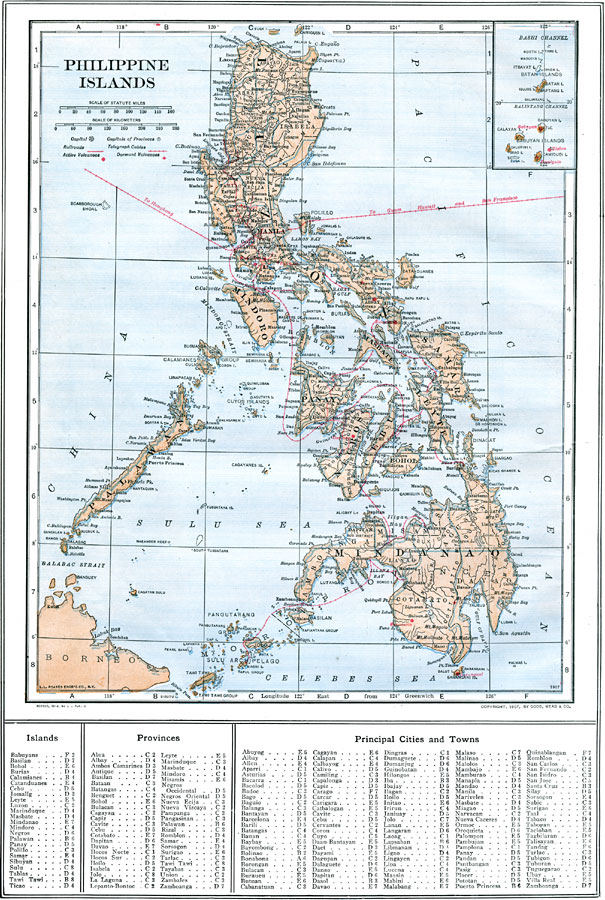
Description: A map from 1914 of the Philippine Islands. The map shows the major islands and surrounding seas, cities, towns, and ports, railroads, submarine telegraph cables to Hong Kong, Guam, San Francisco, and through the islands, province boundaries at the time, rivers, and coastal features. The map also shows active and dormant volcanoes.
Place Names: Philippines, Baguio, �Batangas, �Butuan, �Manila, �Puerto Princesa, �San Fernanad
ISO Topic Categories: boundaries,
oceans,
location,
inlandWaters,
transportation
Keywords: Philippine Islands, physical, �political, �transportation, physical features, county borders, railroads, boundaries,
oceans,
location,
inlandWaters,
transportation, Unknown, 1914
Source: , The New Encyclopedic Atlas and Gazetteer of the World (New York, NY: P. F. Collier and Son, 1914) 46
Map Credit: Courtesy the private collection of Roy Winkelman |
|