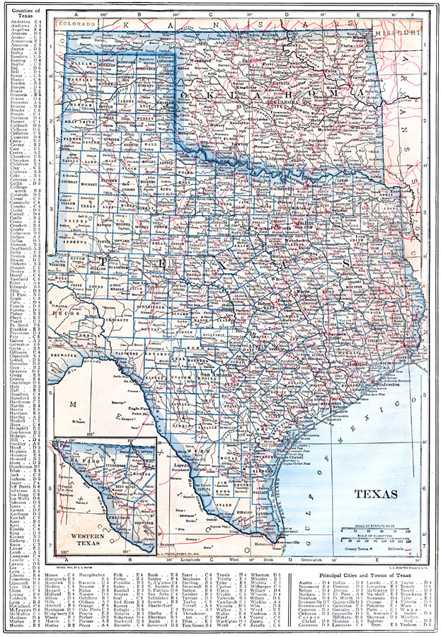
Description: Texas and Oklahoma, showing physical features and railroad routes. Includes an insert of the western point of Texas.
Place Names: Old South States, Waco, �Brownsville, �Houston, �Dallas, �El Paso, �Austin, �Corpus Christi, �Galveston, �San Antonio, �Ardmore, �Perry, �Enid, �Shawnee, �Tulsa, �Oklahoma City, �Wagoner, �Lawton, �Chickasha, �Texas, �Oklahoma, �Old Southwes
ISO Topic Categories: boundaries,
location,
inlandWaters,
transportation
Keywords: Texas and Oklahoma, physical, �political, �transportation, physical features, county borders, railroads, boundaries,
location,
inlandWaters,
transportation, Unknown, 1914
Source: , The New Encyclopedic Atlas and Gazetteer of the World (New York, NY: P. F. Collier and Son, 1914) 50
Map Credit: Courtesy the private collection of Roy Winkelman |
|