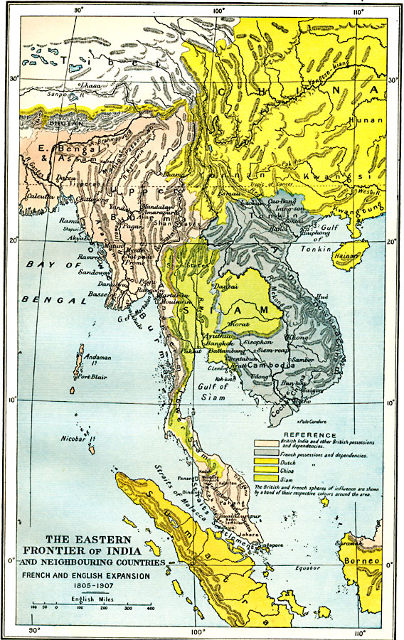
Description: A map of Southeast Asia showing Siam (Thailand), the eastern frontier of British India, French Indo–China, and neighboring countries, subtitled ‘French and English Expansion 1805–1907.’ The map is color–coded to show the territory of Siam in 1805, the British possessions and partition of western Siam, and the French possessions and partition of eastern Siam, the boundaries established by the Anglo–French agreement (Entente cordiale) of 1904. The British possessions and dependencies shown include eastern Bengal, Assam, Burma, Tenasserim (Tanintharyi Division), the Straits Settlements, Federated Malay States, and northern Borneo. The French possessions include Tonkin, Annam, Cambodia, and Cochin China. The map also shows the frontier with China, and the Dutch possessions in Sumatra and southern Borneo. The map shows major cities, mountain systems and terrain, rivers, coastal features, and islands of the region.
Place Names: Southeastern Asia, Borneo, �Burma, �Cambodia, �China, �Myanmar, �Siam, �Singapore, �Sumatr
ISO Topic Categories: oceans,
location,
inlandWaters,
boundaries
Keywords: The Eastern Frontier of India and Neighbouring Countries, political, �historical, country borders,
local jurisdictions,
major political subdivisions, historical event, oceans,
location,
inlandWaters,
boundaries, Unknown, 1805–1907
Source: Ward, Prothero, and Leathes, The Cambridge Modern History Atlas (New York, NY: The Macmillan Company, 1912)
Map Credit: Courtesy the private collection of Roy Winkelman |
|