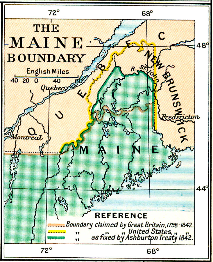
Description: A map of the Quebec, New Brunswick, and Maine area showing the boundary dispute between England and the United States between 1798 and 1842. The map is color–coded to show the boundary claims of the British and United States after 1798, and the boundary as established by the Ashburton Treaty of 1842.
Place Names: A Regional Map of North America, Canada, �United State
ISO Topic Categories: oceans,
location,
inlandWaters,
boundaries
Keywords: The Maine Boundary Dispute, political, country borders,
local jurisdictions,
major political subdivisions, oceans,
location,
inlandWaters,
boundaries, Unknown, 1798–1842
Source: Ward, Prothero, and Leathes, The Cambridge Modern History Atlas (New York, NY: The Macmillan Company, 1912)
Map Credit: Courtesy the private collection of Roy Winkelman |
|