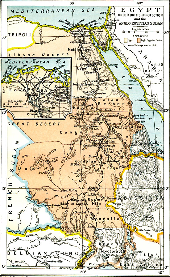
Description: Map of Egypt from the Nile Delta to Victoria Nyanza (Lake Victoria) in 1912, subtitled "Egypt Under British Protection and the Anglo–Egyptian Sudan." This map is color–coded to show Egypt proper in light pink and the Anglo Egyptian Sudan under joint British and Egyptian control. Regional territories of Nubia, Halfa, Dongala, Kassala, Dar Fur, Kordofan and Mongalla are shown. Major cities, trade centers, caravan routes, and railways as of 1910 are shown. The inset map details the Nile Delta, showing Cairo, the Suez Canal, and the extensive rail system.
Place Names: Egypt, Al Kharijah, �Al Minya, �Alexandria, �Asyut, �Cairo, �Luxor, �Marsa Matruh, �Siwah, �Suez, �Tant
ISO Topic Categories: oceans,
location,
inlandWaters,
boundaries
Keywords: Colonial Egypt, political, �transportation, country borders,
local jurisdictions,
major political subdivisions, railroads, oceans,
location,
inlandWaters,
boundaries, Unknown, 1912
Source: Ward, Prothero, and Leathes, The Cambridge Modern History Atlas (New York, NY: The Macmillan Company, 1912)
Map Credit: Courtesy the private collection of Roy Winkelman |
|