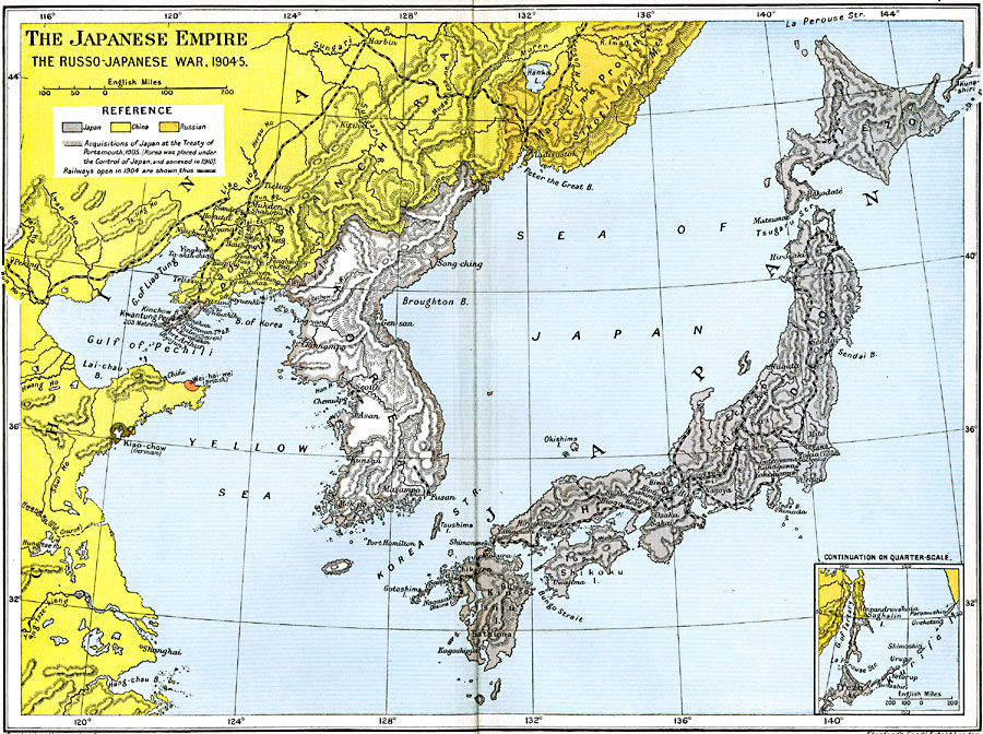
Description: A map of Japan subtitled "The Russo-Japanese War, 1904-5." The map is color–coded to show the Japanese Empire and the territorial acquisitions won by Japan at the Treaty of Portsmouth in 1905, including Korea and Saghalin Island south of latitude 50° North (Inset map), and the territories of China and the Russian Empire. The map shows major cities and ports, railways, rivers, terrain and coastal features, and islands of the region.
Place Names: Eastern Asia, Japan, �Korea, �Manchuria, �Shangha
ISO Topic Categories: oceans,
location,
inlandWaters,
boundaries
Keywords: The Japanese Empire, political, �transportation, �historical, country borders,
local jurisdictions,
major political subdivisions, railroads, historical event, oceans,
location,
inlandWaters,
boundaries, Unknown, 1904–1905
Source: Ward, Prothero, and Leathes, The Cambridge Modern History Atlas (New York, NY: The Macmillan Company, 1912)
Map Credit: Courtesy the private collection of Roy Winkelman |
|