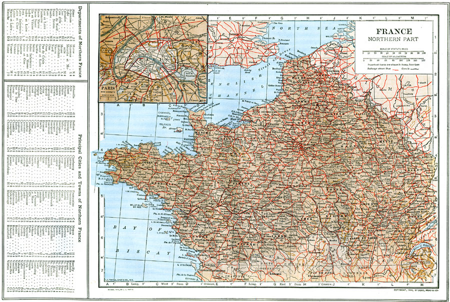
Description: A map of the northern part of France in 1914, showing Departments, major cities and towns, railroad and canal routes, rivers and terrain. This map includes an insert of the Paris vicinity. There is a reference key to the Departments of northern France and major cities and towns.
Place Names: France, Paris, �Nancy, �Orleans, �Tour
ISO Topic Categories: boundaries,
inlandWaters,
location,
transportation
Keywords: Northern France, physical, �political, �transportation, physical features, country borders, water routes,
railroads, boundaries,
inlandWaters,
location,
transportation, Unknown, 1914
Source: , The New Encyclopedic Atlas and Gazetteer of the World (New York, New York: P. F. Collier and Son, 1914) 70
Map Credit: Courtesy the private collection of Roy Winkelman |
|