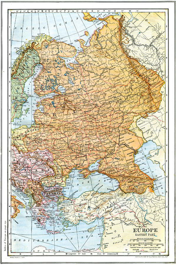
Description: A map from 1914 of the eastern part of Europe showing European Russia (west of the Urals), Romania, Servia, Bulgaria, Albania, Greece, and portions of Austria–Hungary, Sweden, Prussian Empire, and Turkey. The map shows capitals and principal cities, rivers, mountains, railroad and canal routes, and submarine cable routes.
Place Names: Eastern Europe, Germany, �Greece, �Italy, �Poland, �Romania, �Sweden, �Norway, �Finland, �Russia,�German Empire, �Austria-Hungary, �Servia, �Montenegro, �Albania, �bulgaria,
ISO Topic Categories: boundaries,
inlandWaters,
location,
oceans,
transportation
Keywords: Eastern Europe, physical, �political, �transportation, physical features, country borders, railroads,
water routes, boundaries,
inlandWaters,
location,
oceans,
transportation, Unknown, 1914
Source: , The New Encyclopedic Atlas and Gazetteer of the World (New York, NY: P. F. Collier and Son, 1914) 77
Map Credit: Courtesy the private collection of Roy Winkelman |
|