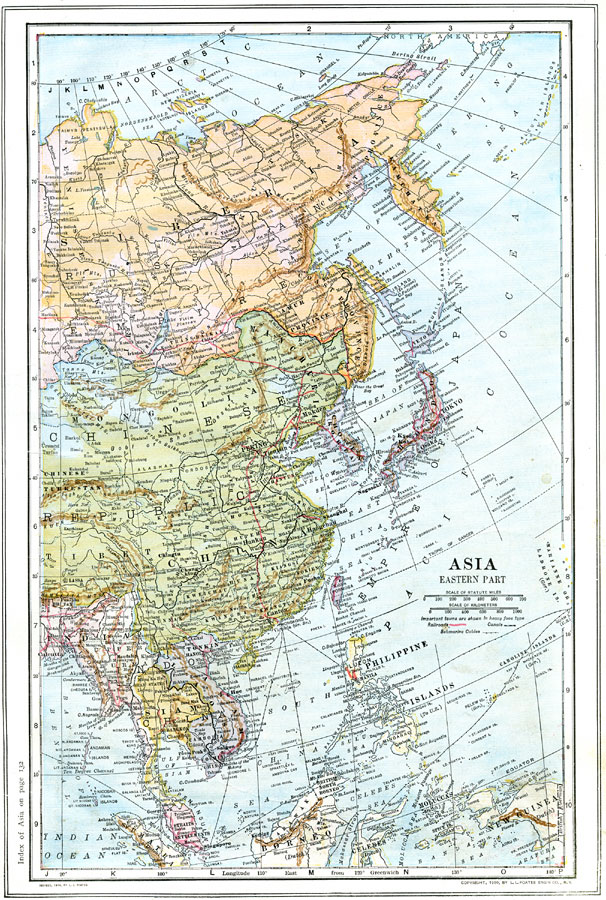
Description: A map from 1914 of East Asia showing the political boundaries of the time, including the Asian portion of the Russian Empire, the Chinese Empire, Korea, the Empire of Japan, and the foreign possessions of Britain, France, Netherlands, and the United States. The map shows capitals and major cities, ports, railways, canals, submarine telegraph cables, lakes, rivers, mountain systems and terrain, coastal features, and islands of the region.
Place Names: Eastern Asia, China, �India, �Russia, �Japan, �Mongolia, �Siberia, �Chosen, �Korea, �Manchuria, �Laos, �Siam, �Tibet, �Philippine Islands
ISO Topic Categories: boundaries,
inlandWaters,
location,
oceans,
transportation
Keywords: Eastern Asia, physical, �political, �transportation, physical features, country borders, railroads,
water routes, boundaries,
inlandWaters,
location,
oceans,
transportation, Unknown, 1914
Source: , The New Encyclopedic Atlas and Gazetteer of the World (New York, NY: P. F. Collier and Son, 1914) 79
Map Credit: Courtesy the private collection of Roy Winkelman |
|