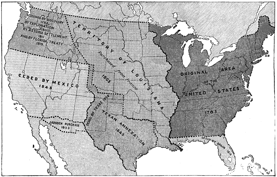
Description: A map from 1914 of the United States showing its acquisition of territory from the original states and Northwest Territory after the American Revolutionary War in 1783 to the Gadsden Purchase in 1853. The dates for each acquisition are given.
Place Names: Growth of Nation, Original area of the United States, �Louisiana Territory, �Texas, �Gadsden Purchase, �Florida,
ISO Topic Categories: boundaries,
inlandWaters,
location,
oceans
Keywords: Territorial Growth of the United States, physical, �historical, physical features, historical event, boundaries,
inlandWaters,
location,
oceans, Unknown, 1783–1853
Source: , The New Encyclopedic Atlas and Gazetteer of the World (New York, NY: P. F. Collier and Son, 1914) 105
Map Credit: Courtesy the private collection of Roy Winkelman |
|