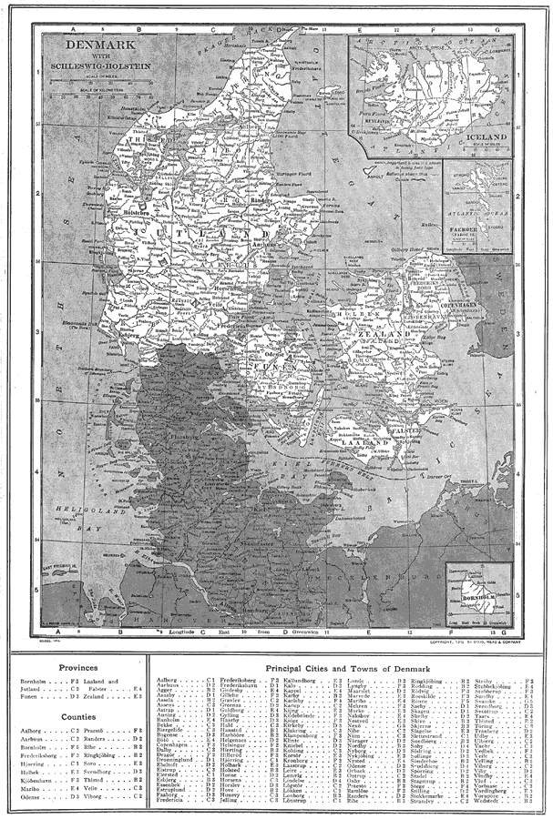
Description: A map of Denmark in 1914 showing Jutland, Zealand, Funen, Laaland (Lolland) Vendsyssel–Thy, Falster and Bornholm, and includes Schleswig–Holstein. This map shows major cities, rivers and coastal features, and ncludes inserts maps of Iceland, Faeroer (Faroe Islands), and Borholm. This map also has a list of place names of provinces, counties, and principal cities and towns of Denmark with location grid reference at the bottom of the map.
Place Names: Denmark, Copenhagen, �Esbjerg, �Helsinger, �Kolding, �Randers, �Ronne, �Skagen, �Iceland, �Reykjavik, �Husavik, �Raufarhof
ISO Topic Categories: boundaries,
inlandWaters,
location
Keywords: Denmark with Schleswig-Holstein, physical, �political, physical features, country borders, boundaries,
inlandWaters,
location, Unknown, 1914
Source: , The New Encyclopedic Atlas and Gazetteer of the World (New York, New York: P. F. Collier and Son, 1914) 138
Map Credit: Courtesy the private collection of Roy Winkelman |
|