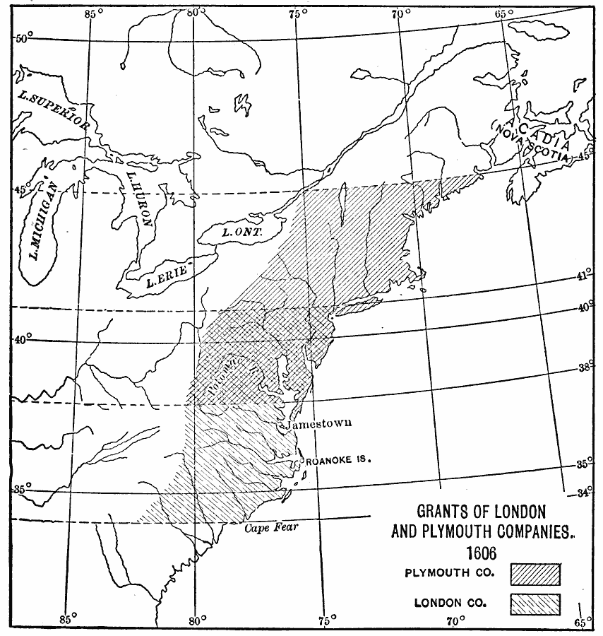
Description: A map of the eastern portion of North America showing the Land Grants of the Plymouth Company from latitudes 38° N to 45° N, the London Company from latitudes 34° N to 41° N, and overlapping territories between latitudes 38° N and 41° N. These grants, established by King James I of England in 1606, extended inland to the watershed divide of the Appalachian Mountains.
Place Names: A Regional Map of North America, Acadia, �Canada, �Jamestown, �Nova Scotia, �United States, �Virgini
ISO Topic Categories: oceans,
location,
inlandWaters
Keywords: Land Grants of the London and Plymouth Companies, physical, country borders, oceans,
location,
inlandWaters, Unknown, 1606
Source: Jacques W. Redway, F.R.G.S., The Redway School History (New York, NY: Silver, Burdett and Company, 1911) 28
Map Credit: Courtesy the private collection of Roy Winkelman |
|