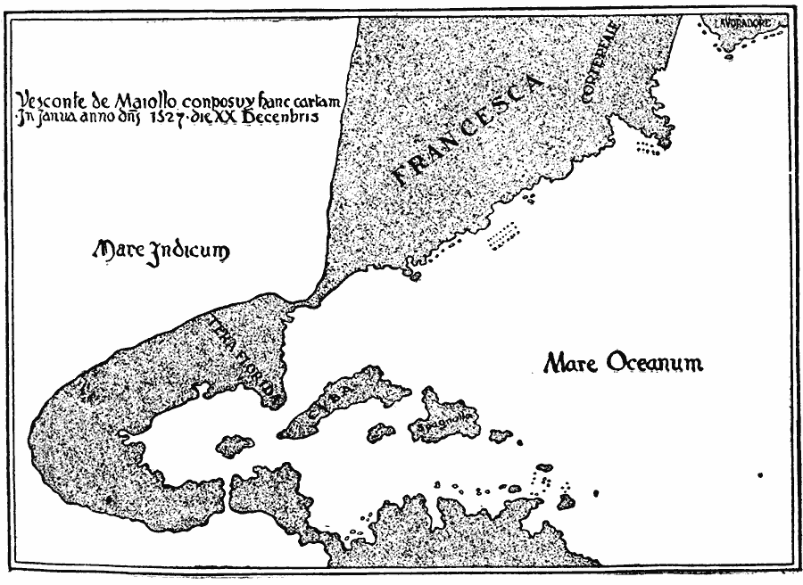
Description: A facsimile copied from the chart made by the brother of Giovanni de Verrazano in 1527, after the 1524 expedition to New York Bay. The map shows Lavoradore (Labrador), Cortereal (the lands explored by the Portuguese João Vaz Corte–Real), Francesca (the region of North America from the Carolinas to Canada), Tera Florida (the region of North America from the Carolinas to Honduras), Cuba, Spagnolla (Hispaniola), Mare Oceanum (Atlantic Ocean), and Mare Indicum (Indian Ocean). The map also shows the isthmus supposed to separate the Atlantic and Indian oceans.
Place Names: Regional Americas, North America, �South Americ
ISO Topic Categories: physical, kEarlyMapsFacsimile, kWorldAmericas
Keywords: The Maiollo Map of the Americas, physical, kEarlyMapsFacsimile, local jurisdictions, physical, kEarlyMapsFacsimile, kWorldAmericas, Unknown, 1527
Source: Jacques W. Redway, F.R.G.S., The Redway School History (New York, NY: Silver, Burdett and Company, 1911) 45
Map Credit: Courtesy the private collection of Roy Winkelman |
|