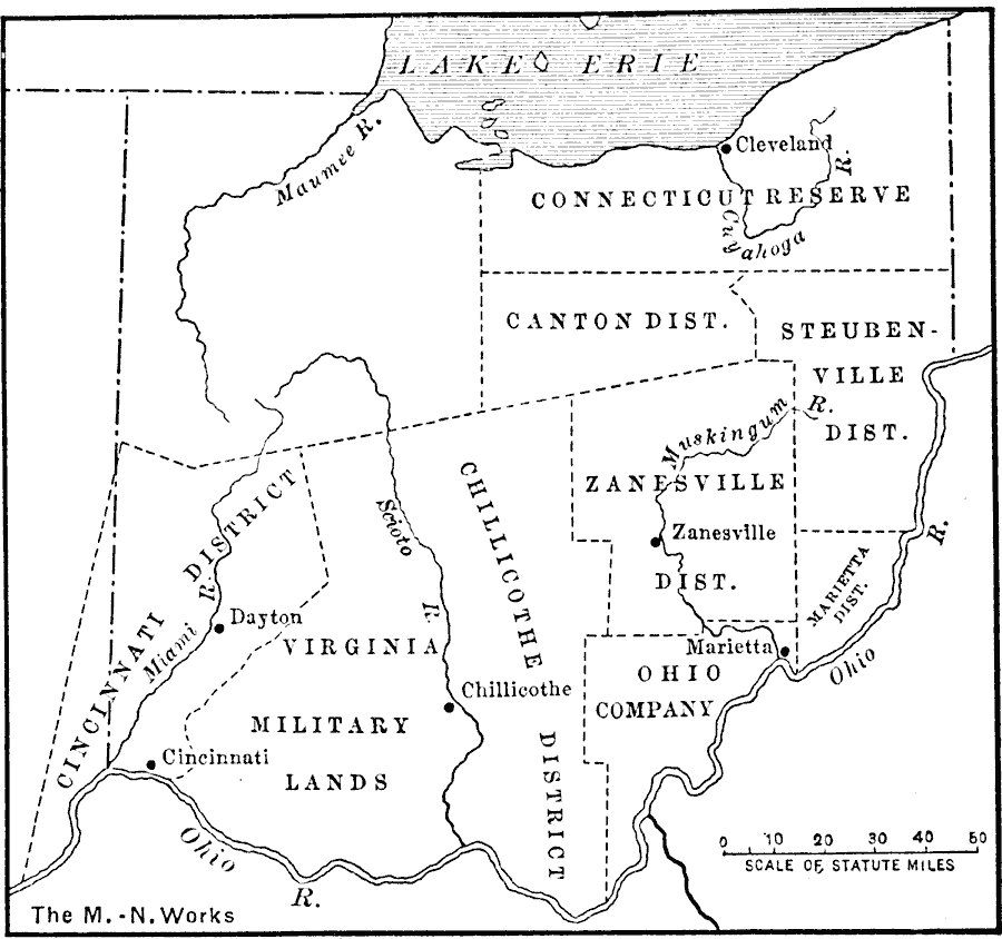
Description: A map of Ohio showing the districts created after the passage of the Ordinance of 1787. "The area of the present state of Ohio was settled by various land companies which purchased districts. When Connecticut ceded her western land claims to the Federal government in 1786, she reserved a section known as the Western Reserve. Part of this land the state gave to certain citizens, and part was sold to a land company. Virginia, likewise, reserved a section to be used to pay her revolutionary soldiers. The Ohio Company was a New England organization directed by the Rev. Manasseh Cutler of Massachusetts." — Redway, 1911, p. 197.
Place Names: Ohio, Canton, �Chillicothe, �Stueubenville, �Zanesvill
ISO Topic Categories: oceans,
location,
inlandWaters,
boundaries
Keywords: The Districts of Ohio, political, local jurisdictions,
major political subdivisions, water routes,
roads, other military, oceans,
location,
inlandWaters,
boundaries, Unknown, 1787
Source: Jacques W. Redway, F.R.G.S., The Redway School History (New York, NY: Silver, Burdett and Company, 1911) 197
Map Credit: Courtesy the private collection of Roy Winkelman |
|