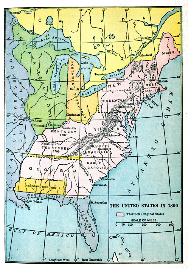
Description: A map of the United States in 1800 showing the original thirteen states with the additions of Vermont (1791), Kentucky (1792), and Tennessee (1796), the State claims to western lands by South Carolina and Georgia, the extent of the Northwest Territory north of the Ohio at the time, the Indian Territory west to the Mississippi River, the western territory ceded by South Carolina in 1787, and the Mississippi Territory between the Mississippi and Chattahoochee rivers. The map also shows the British possessions in Canada and the Spanish possessions west of the Mississippi and the Floridas.
Place Names: Growth of Nation, Connecticut, �Delaware, �Georgia, �New Hampshire, �New Jersey, �New York, �North Carolina, �South Carolina, �Virginia, �Original Colonies, �East Florida, �West Florida, �Northwest Territory, �Indiana Territory, �Mississippi Territor
ISO Topic Categories: oceans,
location,
inlandWaters,
boundaries
Keywords: The United States, political, local jurisdictions,
major political subdivisions, water routes,
roads, other military, oceans,
location,
inlandWaters,
boundaries, Unknown, 1800
Source: Jacques W. Redway, F.R.G.S., The Redway School History (New York, NY: Silver, Burdett and Company, 1911)
Map Credit: Courtesy the private collection of Roy Winkelman |
|