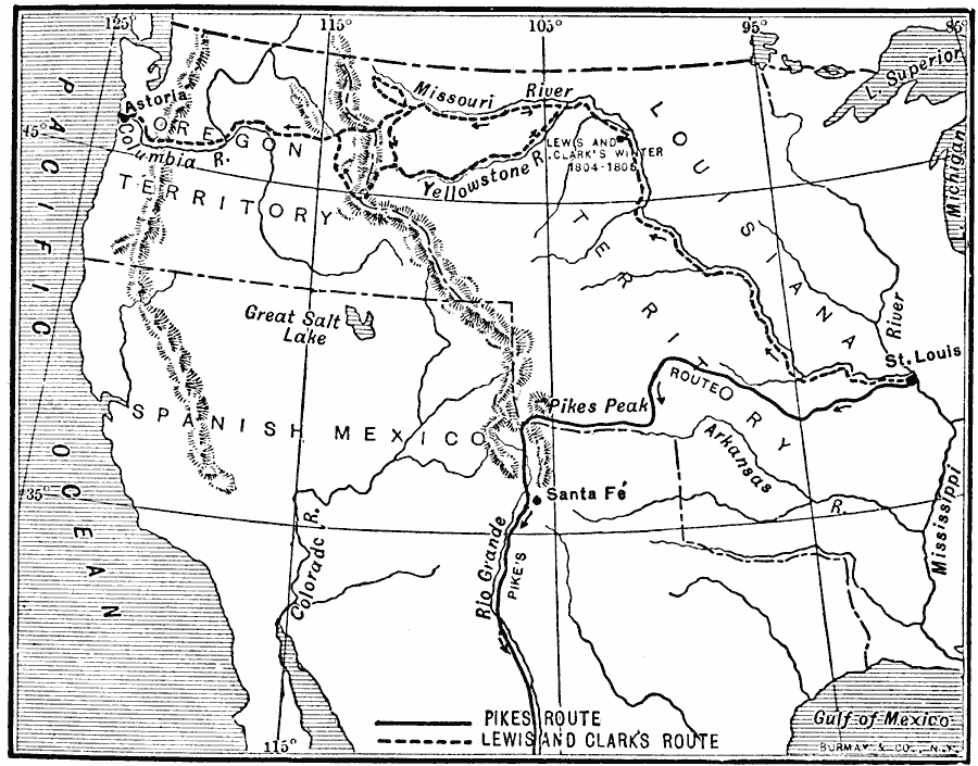
Description: A map of the western United States showing the early exploration routes of Lewis and Clark (1803–1806) and Zebulon Pike (1806–1807) from St. Louis to the western lands.
Place Names: Growth of Nation, Oregon Country, �Western Exploratio
ISO Topic Categories: oceans,
location,
inlandWaters
Keywords: Western Explorations, historical, historical event, oceans,
location,
inlandWaters, Unknown, 1803–1807
Source: Jacques W. Redway, F.R.G.S., The Redway School History (New York, NY: Silver, Burdett and Company, 1911) 211
Map Credit: Courtesy the private collection of Roy Winkelman |
|