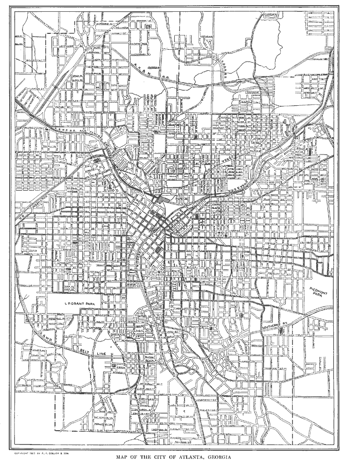
Description: A city plan from 1914 detailing Atlanta, showing the city streets and street names, Union train depot and the rail routes, the State Capitol building and Governor's mansion, the Oakland Cemetery, and L. P. Grant Park, and major landmarks.
Place Names: Georgia, Atlant
ISO Topic Categories: transportation
Keywords: Atlanta, Georgia, transportation, roads,
railroads, transportation, Unknown, 1914
Source: , The New Encyclopedic Atlas and Gazetteer of the World (New York, NY: P. F. Collier and Son, 1914) 148
Map Credit: Courtesy the private collection of Roy Winkelman |
|