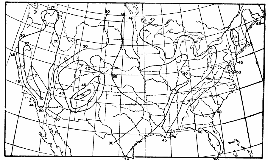
Description: A map from 1896 of the United States showing the percentage of cloudiness in the region for the month of August (midsummer), where 0% is clear and 100% is completely cloudy. "The cloudiness in August is least in the Sierra Nevada region, where it is less than 10%, and is greatest on the southern Pacific coast, the Atlantic coast, and in a small region in northwestern New Mexico, where it varies from 45% to 50% of total cloudiness." Waldo, 1896, pp. 353–354.
Place Names: Meteorology, cloudiness, �cloud coverag
ISO Topic Categories: climatologyMeteorologyAtmosphere,
inlandWaters,
oceans
Keywords: Midsummer Cloudiness, physical, �meteorological, kClimate, physical features, climate, climatologyMeteorologyAtmosphere,
inlandWaters,
oceans, Unknown, 1896
Source: Frank Waldo, Elementary Meteorology (New York, NY: American Book Company, 1896) 354
Map Credit: Courtesy the private collection of Roy Winkelman |
|