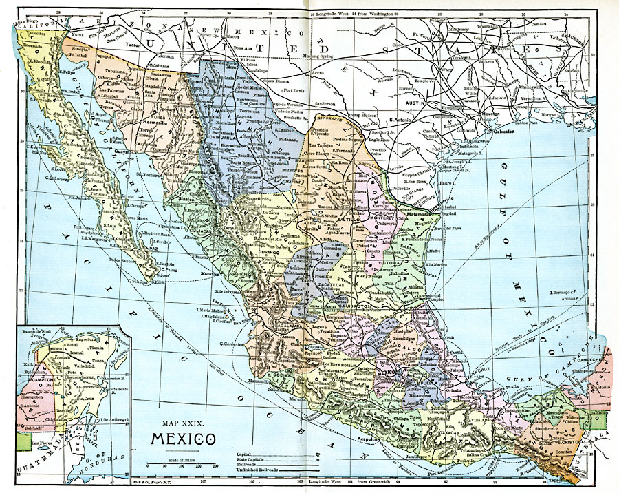
Description: A map from 1885 of Mexico showing the states and state capitals, major cities and towns, existing and proposed railroads, steamship routes with distances and travel times between major ports given, mountain systems, rivers, lakes, and coastal features of the country. An inset map shows the Yucatan Peninsula at the same map scale.
Place Names: Mexico, Hermosillo, �La Paz, �Chihuahua, �Mazatlan, �Acapulco, �Mexico City, �Oaxaca, �San Cristobal, �Campeche, �San Luis Potosi, �Matamoras, �Monterey, �Durango, �Ixtlahuaca
ISO Topic Categories: boundaries,
inlandWaters,
location,
oceans,
transportation
Keywords: Mexico, physical, �political, �transportation, physical features, country borders,
major political subdivisions, railroads, boundaries,
inlandWaters,
location,
oceans,
transportation, Unknown, 1885
Source: John Clark Ridpath LL. D., Cyclopedia of Universal History (Cincinnati, OH: Jones Brothers Publishing Co., 1885) 1312-1313
Map Credit: Courtesy the private collection of Roy Winkelman |
|