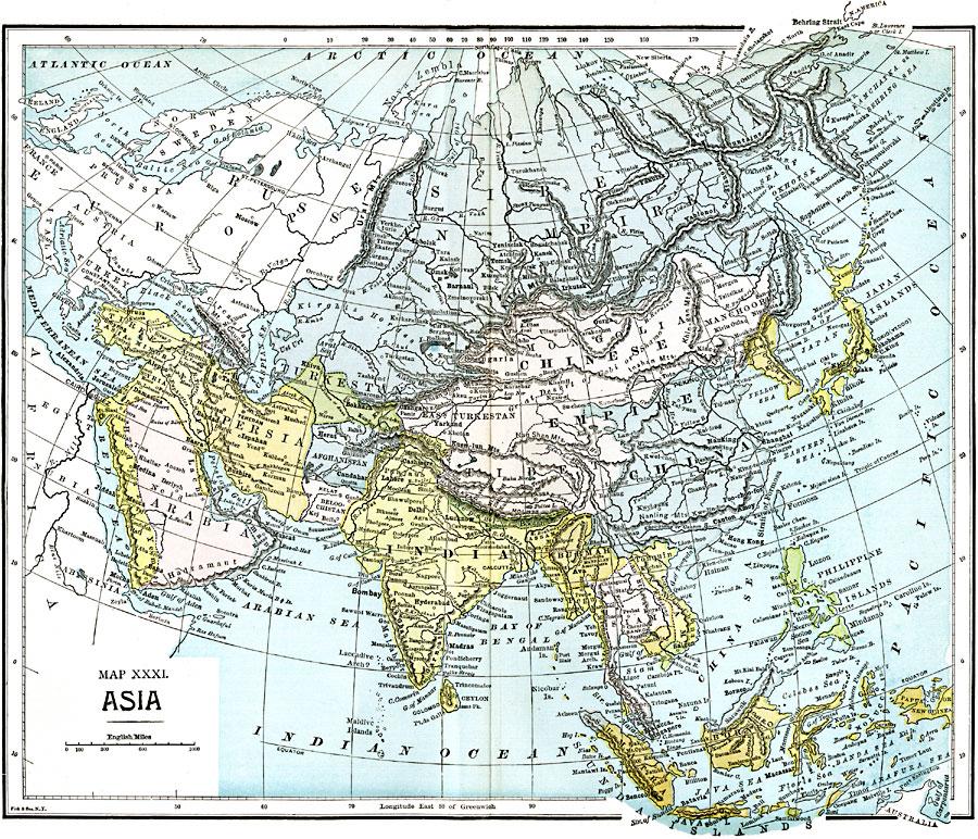
Description: A map of Asia from 1885 showing country boundaries at the time, major cities, rivers, lakes, terrain, and coastal features. This map shows the extent of the Russian Empire and Turkish Ottoman Empire in Asia, the Empire of Japan and Chinese Empire, foreign possessions, and the Great Wall of China.
Place Names: A Complete Map of Asia, Russian Empire, �Chinese Empire, �Manchooria, �India, �Burmah, �Tonquin, �Siam, �Sumatra, �Borneo, �Java, �Papua New Guinea, �Japan, �Corea, �Afghanistan, �Beloochistan, �Persia, �Turkestan, �Arabia, �Turke
ISO Topic Categories: boundaries,
inlandWaters,
location,
oceans
Keywords: Asia, physical, �political, physical features, country borders,
major political subdivisions, boundaries,
inlandWaters,
location,
oceans, Unknown, 1885
Source: John Clark Ridpath LL. D., Cyclopedia of Universal History (Cincinnati, OH: Jones Brothers Publishing Co., 1885) 1328-1329
Map Credit: Courtesy the private collection of Roy Winkelman |
|