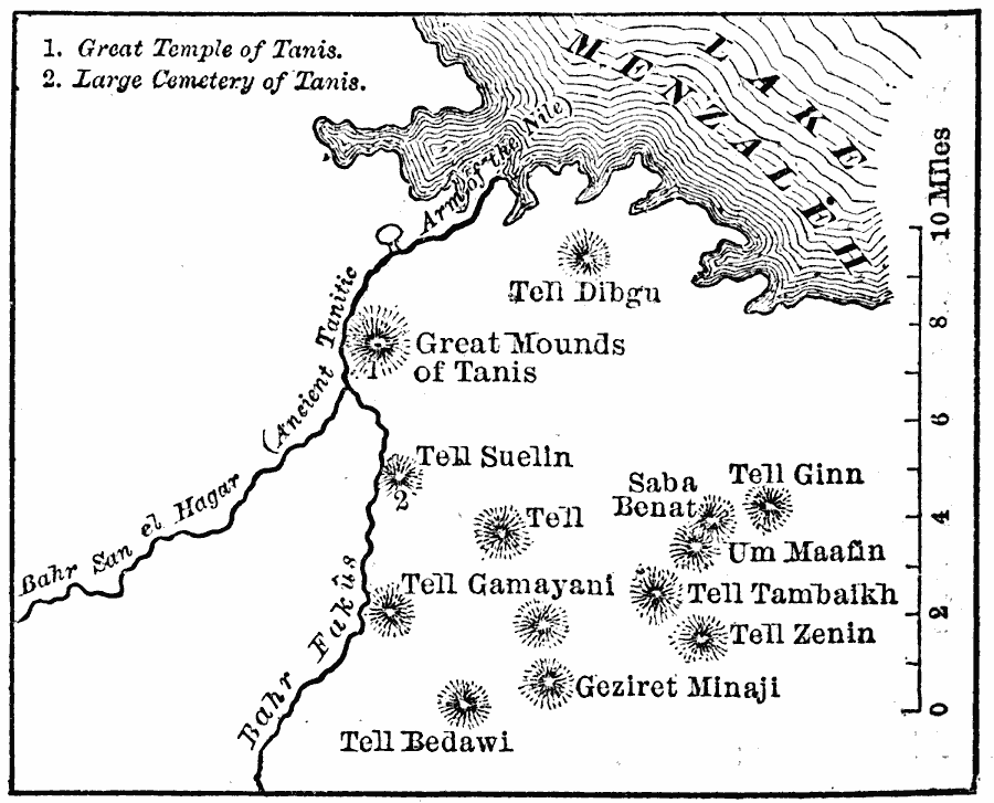
Description: Plan of the ancient Egyptian site of Tanis, often referred to as the Thebes of the North. Tanis was the Lower Egyptian capital during the late period during the nineteenth dynasty. It was built on the Tanitic arm of the Nile River near Lake Menzaleh, a distributary that is now silted–up. This map shows the historic sites of the Great Temple of Tanis, the Cemetery of Tanis, the canals of Bahr San el Hagar and Bahar Fakus, and the Tells (hills) in the area.
Place Names: Egypt, Tell Dibgu, �Tell Suelin, �Tell Gin, �Um Maafin, �Tell Tambaikh, �Tell Zenin, �Geziret Minaji, �Tell Bedawl, �Tell Gamayan
ISO Topic Categories: location,
inlandWaters
Keywords: Tanis, physical, kAncientEgypt, physical features, location,
inlandWaters, Unknown, 1886
Source: , Harper's New Monthly Magazine Volume LXXIII (New York, New York: Harper and Brothers, 1886) 714
Map Credit: Courtesy the private collection of Roy Winkelman |
|