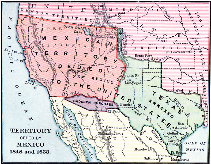
Description: A map of the territory acquired from Mexico including the annexation of Texas in 1845, California, Utah Territory, and New Mexico Territory in 1848, and the Gadsden Purchase in 1853.
Place Names: Growth of Nation, Los Angeles, �San Francisco, �Monterey, �El Paso, �Santa Fe, �San Antonio, �Mexican Cession, �Texas, �California, �Gadsden Purchase, �First Mexican Cession, �New Mexico, �Oregon Countr
ISO Topic Categories: boundaries,
inlandWaters,
location,
oceans
Keywords: Territory Ceded by Mexico, physical, �political, �historical, �Mexican-American War, physical features, country borders,
major political subdivisions, other military, boundaries,
inlandWaters,
location,
oceans, Unknown, 1845–1853
Source: Charles Kendall Adams, A History of the United States (Boston, MA: Allyn and Bacon, 1909) 303
Map Credit: Courtesy the private collection of Roy Winkelman |
|