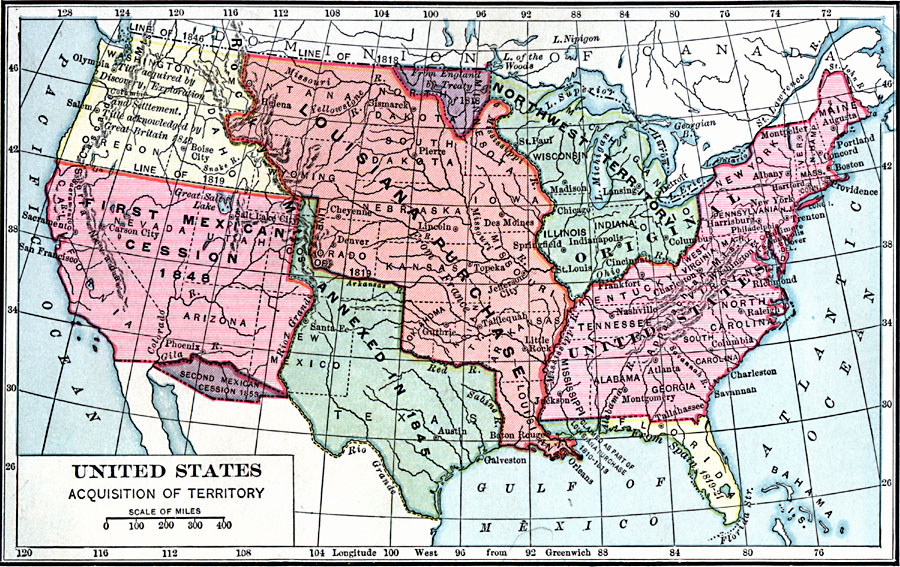
Description: A map of the United States showing the territorial acquisitions up to the Gadsden Purchase in northern Mexico in 1853. The map is color–coded to show the territory of the original United States and the Northwest Territory (1783), the Louisiana Purchase (1803), the area acquired from Britain in 1818 west of the Lake of the Woods, Florida in 1819, the annexation of Texas in 1845, the Oregon Country in 1846, the first Mexican cession in 1848, and the second Mexican cession (Gadsden Purchase) in 1853.
Place Names: Growth of Nation, Sacramento, �San Francisco, �Austin, �Tallahassee, �Albany, �Concord, �New Yor
ISO Topic Categories: boundaries,
inlandWaters,
location,
oceans
Keywords: United States Acquisition of Territory, physical, �political, physical features, country borders,
major political subdivisions, boundaries,
inlandWaters,
location,
oceans, Unknown, 1853
Source: Charles Kendall Adams, A History of the United States (Boston, MA: Allyn and Bacon, 1909) 305
Map Credit: Courtesy the private collection of Roy Winkelman |
|