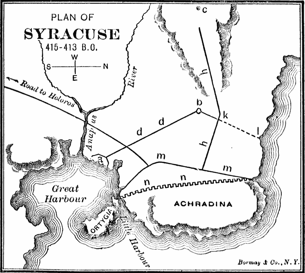
Description: A plan of the Greek colony of Syracuse during the years 415 to 413 BC, at the siege of Syracuse in the Peloponnesian War. The map shows Athenian naval camp (a), the Athenian fort (b), the height at the rear of the Athenian line (c), the Athenian Wall (d,d), the unfinished part of the Athenian Wall (k,l), the ancient wall of Syracuse (n,n), the new wall of Syracuse – 415 BC (m,m), and the third Syracusan cross–wall (h,h).
Place Names: Italy, Syracus
ISO Topic Categories: structure,
transportation,
intelligenceMilitary,
inlandWaters,
location,
oceans
Keywords: Plan of Syracuse, physical, �political, �transportation, �historical, �peloponnesian war, kAncientGreece, physical features, local jurisdictions, roads, other military, structure,
transportation,
intelligenceMilitary,
inlandWaters,
location,
oceans, Unknown, 415–413 B.C.
Source: George Willis Botsford, Ph. D., A History of Greece (London, : The Macmillan Company, 1912) 213
Map Credit: Courtesy the private collection of Roy Winkelman |
|